How Point Cloud to BIM Helps Surveyors Save Time and Cut Costs

Surveying is all about finding that perfect spot between speed and accuracy—rush the job, and you risk missing important details; take your time, and you blow the budget on extra hours. That push-and-pull of opposing forces perfectly captures the essence of what’s known as the time-cost trade-off (TCTO) theory in construction.
Luckily, point cloud to BIM technology gives you a way to have both. By collecting spatial information more efficiently, you can increase the cost-effectiveness of the project by minimizing time spent on-site. With digital twins, you can get the spatial data you need for every phase of a project.
In the sections ahead, we’ll break down the practical benefits of point cloud to BIM technology, explore where it fits in the surveying lifecycle, and share how Matterport can help you in that process.
The goal? To help you strike that ideal balance between efficiency and accuracy—and watch your bottom line improve in the process.
What is a point cloud to BIM?
Point cloud to BIM, sometimes called scan to BIM, is a process that converts 3D laser scan data of physical structures into detailed Building Information Models. It works by capturing millions of data points (the “point cloud”) from laser scans or other reality-capture methods to give you a building’s exact geometry.
5 ways surveyors benefit from the point cloud to BIM process
So, what does point cloud to BIM mean for surveyors like you? In simple terms, it replaces much of the manual measurement process while still giving you actionable, high-fidelity models.
This drastically reduces your time spent on-site and delivers better accuracy, faster turnaround, and deeper insights. And that’s just the start.
Below, we’ve broken down some of the benefits you’ll see from this process.
1. Save time and money by capturing everything you need in one visit
Because point cloud to BIM gathers all essential data in a single pass, it virtually eliminates the need for multiple site visits, rework, and those last-minute surprises that can derail a project’s schedule.
And it’s not just about those savings—one study shows that using digital twins can cut building energy costs by over 14%, highlighting how comprehensive, data-driven workflows can drive long-term benefits.
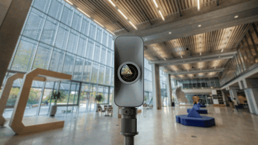
Moreover, Matterport’s Pro3 Camera takes this process further by capturing intricate indoor and outdoor environments in one go. When paired with the TruePlan™ add-on, you can quickly convert point cloud data into BIM-compatible models, slashing the time spent on manual tasks. Ultimately, this helps you accelerate project timelines and sets you up for operational savings down the line.
2. Get highly accurate data that drives better project outcomes
Point cloud surveys offer a more complete view of your project, giving you a solid data foundation for every decision—especially when you’re dealing with complex buildings or equipment-heavy environments.
As explained in a recent Building Design + Construction article, combining LiDAR scans with BIM tools allows you to capture existing conditions in a single pass. You can scan everything from structural layouts to the mechanical, electrical, and plumbing (MEP) components in a single visit, then transfer that data to BIM software like Autodesk Revit to refine it further.
Here’s the catch with traditional LiDAR setups, though: they’re often pricey and require specialized training, so they’re not always readily available. That scarcity can bottleneck your entire workflow, delay your timelines, and add unnecessary complexity. And if you do manage to get your scans, you’re still stuck with time-intensive post-processing before you can use any of the data.
The good news:
At around $6,000, the Matterport Pro3 comes in $15,000 cheaper than the latest Leica BLK360.
It scans at 100,000 points per second, captures a full spherical view in 20 seconds, and achieves ±20mm accuracy at 10 meters.
Plus, Pro3 delivers high-res spherical imagery, and our software can blend laser data with photogrammetry.
If you’re dipping your toes into LiDAR, the Pro3 is a solid, budget-friendly place to start—especially compared to pricier alternatives.
3. Tackle historical or complex structures with ease
Asen’s Fortress captured with Matterport Pro3
As noted in The American Surveyor, the point cloud to BIM process can make a huge difference when you’re working with:
Legacy or heritage buildings, where you need to preserve historical structures
In complex environments or renovations, where traditional methods can be invasive and risk damaging or destabilizing the site.
In fact, research shows that laser scanning or photogrammetry can even capture dense point clouds of complex timber roofs and then convert them into accurate, high-quality 3D models for structural analysis with minimal manual tweaks.
And the payoff is huge. Instead of spending months on manual measurement, you can wrap everything up in about a week, all while capturing every beam, connection, and dimension. In other words, it’s a fast track to better data, fewer surprises, and a more confident structural assessment.
And Matterport shines here, too. Aryn Bergman, lead engineer and founder of TL Circle, ran into major hurdles when modeling complex mechanical rooms.
Typically, it took 4–5 hours for a contractor to capture measurements of a single boiler room, plus another 4–5 days for an engineer to model everything in Revit—on top of any additional site visits.
With Matterport scanning, Bergman cut measuring time by 60%, and our point clouds made Revit modeling 40% faster—ultimately, slashing field-to-finish time by 50%.
4. Bring large-scale projects to life with 360-degree visualizations
Point cloud to BIM is particularly useful for large-scale projects, as it gives you immersive, interactive models that make even the most complex sites easier to understand.
As the GIM International article shows, new algorithms can now automatically segment and classify even highly detailed interiors, bringing you closer to creating full digital twins and BIM projects. That’s a major win for surveyors capturing every architectural nuance, from floors and ceilings to quirky non-planar elements, all in one streamlined workflow.
So, instead of wading through endless 2D plans, you can go on a 3D virtual walkthrough to identify potential issues and reduce the need for multiple site visits. Specifically:
It’s possible to capture every nook and cranny, from intricate architectural elements to MEP systems, in one sweep.
With everyone viewing the same detailed model, communication gaps shrink, and decisions get made faster.
Link your BIM model to real-time data, and you’re on your way to a fully functional digital twin.
That’s not all. Research on BIM for smart buildings highlights how point cloud data supports everything from design optimization to facility maintenance, making your projects more sustainable, too.
5. Share data seamlessly for smoother collaboration
Collaboration is key to finishing projects on time and staying within budget, but communication gaps and inconsistent information often cause delays and expensive rework.
Point cloud to BIM technology tackles this by creating accurate, shareable 3D models that keep everyone on the same page with up-to-date data. By extension, this means easier coordination, greater clarity, and more alignment with multidisciplinary teams.
The evidence backs this, too. As noted in a highway construction project case study (Yuanchen Expressway), point clouds made collaboration and communication smoother by offering a clear, reliable reference for project data—among other benefits.
How are point clouds to BIM used throughout the project lifecycle?
Point cloud to BIM technology offers a versatile solution that supports critical applications at each phase of architecture, engineering, and construction from initial project planning to construction and long-term facilities management.
Let’s look at each below.
Set the foundation during the design phase
During the design phase, surveyors often have to capture essential building elements (walls, beams, columns, and load-bearing elements), factor in non-geometric attributes (like materials or usage data), and determine the right Level of Detail (LOD).
By leveraging point cloud to BIM early on, you can ensure accurate architectural details while preserving the project’s design integrity—especially for retrofit, renovation projects, or restoration work.
A real-world example: after a devastating earthquake in Nepal, an international nonprofit used point cloud to BIM (laser scans) to gather precise as-built data of the disaster-hit villages and damaged structures. This allowed new designs to meet modern safety standards without losing sight of the original structures’ character.
Ultimately, starting with a reliable, data-rich BIM model sets the stage for stronger outcomes throughout the project lifecycle.
Ensure safety during the construction phase
Point cloud to BIM also works as your first line of defense against on-site surprises. By simulating conditions before construction starts, you can identify potential MEP clashes, coordinate workflows, and eliminate many frustrating last-minute changes.
And you're not dodging just day-to-day hazards. According to an AZoBuild article on seismic safety, digital twins and point clouds to BIM can predict how a building (residential and commercial) or infrastructure project (eg. bridges, utility networks etc.) might respond to an earthquake, so you can work necessary safeguards into the design right away.
In the long run, that same data helps you monitor performance and plan retrofits, keeping structures resilient against natural disasters well after construction wraps up.
Revolutionize facilities management and renovation
Point cloud to BIM doesn’t end when construction wraps up—it’s a powerful solution for ongoing facility management and renovation planning.
In practice, that means you can:
Capture every angle of a building’s interior and exterior so you always have an up-to-date digital record.
Quickly pinpoint areas that need maintenance or retrofitting, reducing disruption to day-to-day operations.
Access high-risk or hard-to-reach locations via drone, lowering the likelihood of on-site injuries.
And Matterport can help you along the way.
Make the most of point cloud to BIM with Matterport
Pro3 3D Camera – 3D digital twin capture reimagined | Matterport
Whether you’re tackling a new build or renovating a historic site, a solid point cloud to BIM workflow helps you cut down on-site visits and maintain reliable data from start to finish. Matterport fits right into that process with features built to work seamlessly in BIM environments:
Pro3 Camera with LiDAR: Ensures precise indoor and outdoor captures for accurate point cloud generation.
MatterPak: Offers point clouds, high-resolution floor plans, and OBJ files to jumpstart your modeling.
E57 File Support: Produces high-density point cloud files for 3D modeling in Revit, AutoCAD, and similar tools.
By combining these tools, you’ll spend less time measuring on-site and more time focusing on the decisions that move your project forward.
Want to try Matterport? Hire a capture technician and see how digital twins can elevate your construction planning workflows.