


 Sign In
8 Best Scan to BIM Software for AEC Teams [2026 Guide]
3D laser scans capture a building exactly as it stands, down to the sagging ceiling grid and the pipe that was installed six inches off the drawings. Turning that raw data into structured BIM data powers renovation, retrofit, and as-built documentation.
Scan-to-BIM software is any application that takes point cloud data, photogrammetry, or LiDAR captures and converts them into structured BIM models. The work happens in stages: registering overlapping scans into one coordinate system, cleaning noise, extracting features like walls and pipes, and exporting the result to a BIM-authoring platform such as Autodesk Revit.
The tool you pick shapes the entire production chain. It affects how spaces get captured upstream and how models get coordinated and shared downstream across design, construction, and operations. The strongest solutions are interoperable by design, moving data between capture devices, point cloud processors, and BIM platforms without choking the workflow at a handoff.
This guide compares eight scan-to-BIM solutions, covering both dedicated software and platforms that bundle capture with BIM output, so you can match the best tool to your AEC workflows.
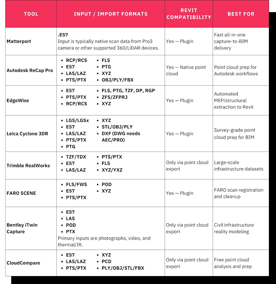
Important note: The tools on this list are organized by workflow role and use case, not ranked. Many AEC teams combine multiple tools, including reality capture, point cloud processing, and BIM authoring, rather than choosing one over another.
1. Matterport: Best all-in-one scan-to-BIM workflows
Matterport is a spatial data platform that combines reality capture, cloud-based processing, and BIM file delivery in one workflow. Instead of stitching together separate tools for scanning, point cloud processing, and model creation, teams capture a space once and move it through documentation, coordination, and export from a single environment. The end-to-end coverage sets Matterport apart from the processing-only tools further down this list.
Supported formats: .E57 Matterport is not a file-import tool in the traditional sense. Point Cloud Imports are available for processing of existing point clouds. Otherwise, data typically comes from capture hardware like the LiDAR-based Pro3 camera and other supported 360 cameras, and captures are processed in the cloud. Output formats include E57, OBJ, RVT, DWG, IFC, RCS and XYZ files.
Accuracy: The Pro3 camera captures with ±20 mm accuracy at 10 m range and scans are converted into LOD 200 BIM outputs.
Scan-to-BIM turnaround: Hours to roughly one or two days for cloud processing and BIM export, depending on project size and service turnaround.
Revit compatibility: Yes, via the free Matterport Autodesk Revit plugin with no file conversion needed.
Pricing: BIM files, E57 exports, and MatterPak bundles are purchased as add-ons per space and require a Professional plan or higher, starting at $90 per month, billed annually
Features
Matterport handles the Scan-to-BIM workflow as part of a broader package:
All-in-one capture-to-BIM pipeline takes you from field scan to BIM deliverable without leaving the platform.
Autodesk Revit plugin imports E57, XYZ, RVT, and BIM files directly from a Matterport account.
Digital twins automatically produced, providing navigable 3D models of every captured space rather than a flat file.
Flexible BIM file output offers five tiers, from architecture-only to architecture plus complex MEP plus industrial spaces.
E57 point cloud exports deliver a vendor-neutral format that plays well across AEC platforms.
Cloud-based processing automatically aligns and stitches spatial data after upload.
Together, these capabilities carry a project from capture to a Revit-ready deliverable on one platform.
Strengths
Matterport supports a range of capture devices, including the Pro3 camera and a number of other 360 cameras. This means teams can match the capture method to the job, using a survey-grade scanner for a plant room or a less expensive device for a quick fit verification.
Every scan produces a navigable 3D digital twin that persists long after capture, serving as a visual reference across design, construction, and operations rather than a one-time point cloud file that gets archived and forgotten.
Cost savings can be substantial. HH Angus’s Director of Digital Services reported roughly 70% savings on BIM file creation using Matterport, with those reductions passed directly to clients.
Limitations
Matterport BIM outputs meet LOD 200 specifications, which is a strong baseline for as-built modeling, but teams needing fabrication-level detail may require additional refinement. For sub-millimeter precision or survey-grade control, it makes sense to complement Matterport with a terrestrial laser scanner in specific areas. Teams can bring in externally generated E57 scan data using Point Cloud Import, which makes it a flexible downstream environment for visualization, coordination, and delivery.
Best for
Matterport is ideal for AEC teams that want to capture existing conditions and produce BIM-ready deliverables from one platform. You capture a space once and make that data usable across several downstream scan-to-BIM pathways: a delivered BIM file, a raw point cloud, or a mesh for another modeling tool.
It's especially strong for projects where speed and interoperability outweigh the need for sub-millimeter survey-grade precision.
2. Autodesk ReCap Pro: Best professional point cloud processing
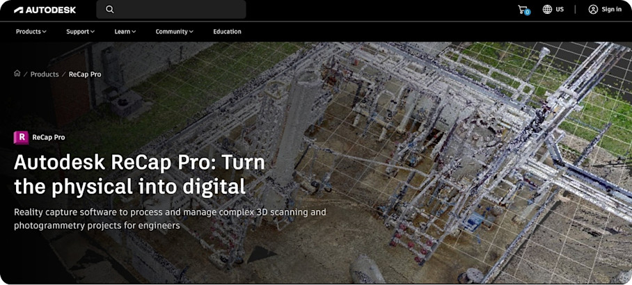
Autodesk ReCap Pro is a dedicated point cloud processing tool built to import, clean, and prepare laser scan data for use in other Autodesk products like Revit, AutoCAD, and Navisworks. It sits early in the pipeline, turning messy field data into a clean, registered point cloud that is ready for modeling.
Supported formats: E57, RCP, RCS, and most major scanner-native formats for input. RCP/RCS for output.
Accuracy: Preserves source scan accuracy, with noise filtering and cleanup tools to improve point cloud quality.
Scan-to-BIM turnaround: Minutes to several hours to register and prepare point clouds, depending on dataset size and complexity.
Revit compatibility: Native point cloud import into Revit via RCP/RCS.
Pricing: Available as a standalone subscription, roughly $370 per year, or as part of the Autodesk AEC Collection.
Features
ReCap Pro's standout features center on preparation, not modeling:
Scan registration aligns multiple scans into a single coordinate system.
Alignment tools fine-tune how individual scans fit together.
Noise filtering and cleanup strip out stray points and clutter.
Broad format support pulls in data directly from most major terrestrial laser scanners.
Tight Autodesk integration feeds cleaned data straight into Revit, AutoCAD, and Navisworks.
Strengths
ReCap Pro is the default point cloud processing tool inside Autodesk workflows. For teams already invested in Revit, AutoCAD, and Navisworks, it's the natural choice because the data flows without conversion headaches. You can measure, edit, and use these files in other software like AutoCAD, Revit, InfraWorks, and Navisworks.
It also pairs cleanly with Matterport. Matterport files integrate directly into ReCap Pro, which makes it a useful complement when you want extra cleanup control before modeling.
Limitations
ReCap Pro is a processing tool, not a modeling tool. It prepares point clouds for use in Revit, but it doesn't create BIM elements on its own.
Teams still need manual Revit modeling expertise to convert the processed point cloud into a usable BIM model. And ReCap Pro includes no capture hardware or capture services of its own, so you're bringing your own scanner or scan data to the table.
Best for
ReCap Pro is for teams already working in the Autodesk ecosystem that need a reliable way to clean and register point clouds before manual BIM modeling in Revit. If your modelers live in Revit all day, this is the preprocessing layer they'll reach for.
3. EdgeWise: Best AI-assisted BIM model creation
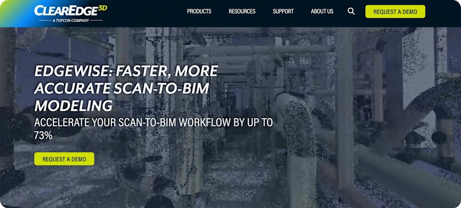
EdgeWise is an AI-powered scan-to-BIM tool that automates the extraction of building elements from point cloud data and generates Revit-native models. It rapidly extracts model geometry from mobile and terrestrial point clouds, so teams complete projects faster and more accurately than with manual methods.
Supported formats: E57, RCP/RCS, PTX, PTS for input. RVT with native Revit families for output.
Accuracy: High for supported element types like pipes, ducts, and structural steel, with extraction precision tied to scan density and coverage.
Scan-to-BIM turnaround: Hours to days for automatic element extraction, followed by manual validation and refinement.
Revit compatibility: Yes, via a dedicated Revit Plugin.
Pricing: Quote-based and varies by module, with EdgeWise Lite starting around $1,995 per year.
Features
EdgeWise’s defining features focus on automation:
AI-driven feature extraction automatically identifies and models walls, pipes, ducts, structural steel, and other elements from point clouds.
Native Revit families mean generated models drop straight into standard BIM workflows.
Architectural and MEP extraction covers both building shell and mechanical systems.
Strengths
EdgeWise cuts down the manual labor of building BIM models using AI extraction from point clouds. The software is especially strong at detecting pipes and ducts from both mobile and terrestrial point clouds, which makes it a fit for detailed mechanical, electrical, and plumbing documentation.
Limitations
The learning curve runs steeper than a simple point cloud viewer, though the vendor positions it as more approachable than comparable modeling tools. EdgeWise is also optimized for specific element types, so it may not cover every architectural or specialty element you need.
Remember also that AI extraction still needs a human check. Complex geometries, custom families, and areas with incomplete scan coverage will all require manual review and cleanup.
Best for
EdgeWise fits teams with large-scale MEP documentation needs who want to automate as much of the point-cloud-to-Revit pipeline as possible. It shines in industrial and mechanical environments where repetitive piping and duct runs would otherwise eat days of manual modeling.
4. Leica Cyclone 3DR: Best for surveying and engineering projects
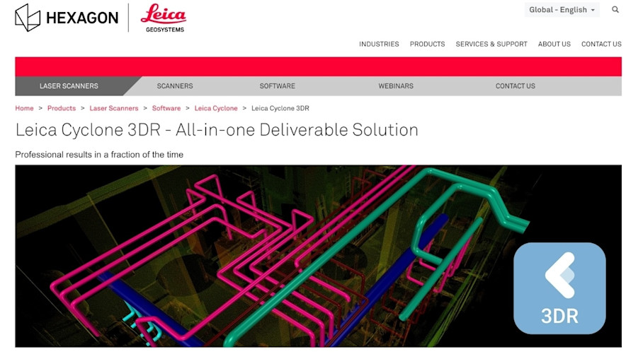
Leica Cyclone 3DR is a point cloud processing and modeling tool from Leica Geosystems. It leans toward precision work: deviation analysis, inspection, and advanced measurement based on survey-grade accuracy.
Supported formats: E57, PTX, PTS, LAS, and Leica-native formats for input. IFC, DXF, OBJ for output.
Accuracy: Survey-grade, sub-millimeter precision with Leica scanner data, plus inspection tools for deviation analysis against design models.
Scan-to-BIM turnaround: Hours to days for registration, cleanup, analysis, and preparation before BIM modeling.
Revit compatibility: Yes, via the Leica CloudWorx plugin for Revit.
Pricing: Sold through Leica Geosystems resellers, typically quote-based depending on license type and modules.
Features
Cyclone 3DR's feature set reflects its surveying roots:
Mesh-to-BIM and point-cloud-to-BIM workflows handle both dense meshes and raw scans.
Automatic surface detection, mesh generation, and feature extraction speed up modeling of complex geometry.
Survey-grade measurement and inspection tools support tight-tolerance QA work.
Leica ecosystem integration connects directly with BLK and RTC series scanners.
Strengths
Cyclone 3DR delivers survey-grade accuracy for applications where sub-millimeter tolerances aren't negotiable. Its inspection and quality assurance tools are genuinely powerful, letting teams compare point clouds against CAD or BIM models to flag deviations.
Native support for Leica scanner data keeps processing overhead low. If your field crew runs Leica hardware, the data lands in Cyclone 3DR with minimal friction.
Limitations
The workflow is tightly coupled with Leica hardware. Teams using other scanner brands may find the experience less seamless than with a vendor-neutral tool. The overall Leica ecosystem carries a high price tag, which can put it out of reach for smaller firms.
The interface can also feel complex to anyone who isn't a trained surveyor or scan processing specialist.
Best for
Cyclone 3DR is best suited to surveying firms and engineering teams already using Leica scanners who need precise measurement, inspection, and modeling in one integrated workflow. It's built for projects where being off by a fraction will create a serious problem.
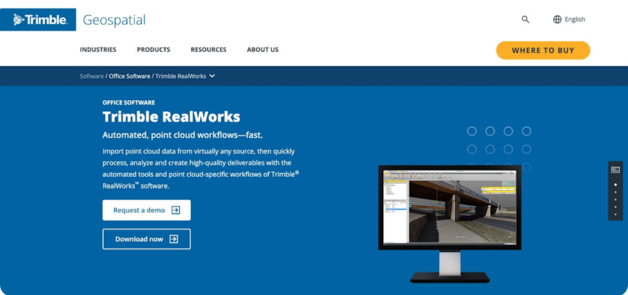
5. Trimble RealWorks: Best for large-scale construction projects
Trimble RealWorks is a point cloud processing and analysis platform aimed at large-scale construction, civil engineering, and infrastructure projects. It's designed to chew through massive datasets that would bog down lighter tools, and it connects deeply into the rest of the Trimble stack.
Supported formats: E57, LAS, PLY, and Trimble-native formats for input. Outputs in RCP/RCS, E57, and DXF.
Accuracy: Survey-grade with Trimble X7 and X9 scanners, plus surface comparison and volumetric analysis tools for verification.
Scan-to-BIM turnaround: Typically 1-3 weeks, dependent on manual modeling in Tekla or Revit after processing.
Revit compatibility: RCP/RCS and E57 exports available for manual import into Revit.
Pricing: Per-seat and typically quote-based. Usually falling from $5,170 for an entry-level Starter edition up to roughly $11,425 for permanent advanced licenses.
Features
RealWorks focuses on organizing and analyzing big scan datasets:
Registration, segmentation, and classification tools organize and prepare large scan datasets.
Native Trimble interoperability connects hardware, software, and Tekla Structures.
Automated feature extraction speeds up the modeling prep.
Surface modeling supports earthwork, terrain, and structural analysis.
Strengths
RealWorks handles very large point cloud datasets that are common in infrastructure and heavy construction without falling over. That capacity is its main draw
It integrates deeply with the Trimble construction ecosystem, including SketchUp, Tekla, and Trimble Connect. It also carries strong tools for volumetric analysis, surface comparison, and progress monitoring, which are useful on active job sites.
Limitations
Large datasets demand serious processing power, and RealWorks relies on desktop workflows rather than cloud processing. That means your hardware, not a remote server, sets the pace.
Per-seat licensing costs add up quickly for larger teams. And teams outside the Trimble ecosystem may find interoperability more limited than with a vendor-neutral tool.
Best for
RealWorks fits construction and civil engineering teams already invested in Trimble who need to process large-scale point clouds for infrastructure, earthwork, or structural projects. If Tekla is your preferred structural authoring tool over Revit, this is a great scan-to-BIM solution.
6. FARO SCENE: Best for FARO laser scanning workflows
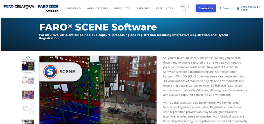
FARO SCENE is a proprietary point cloud processing software built to register, visualize, and export point cloud data captured by FARO laser scanners. It's a registration and cleanup engine, not a modeling tool, so it lives at the front of the pipeline.
Supported formats: FLS (FARO native), E57, PTX, PTS, XYZ for input. E57, RCP/RCS, PTS, XYZ for output.
Accuracy: Millimeter-level when paired with FARO Focus scanners, which carry a ranging error around ±1 mm.
Scan-to-BIM turnaround: Anywhere from one day to several weeks depending on the project size and the required detail level.
Revit compatibility: Exports E57 and RCP/RCS are available for manual Revit import.
Pricing: Available as a standalone license from around $2,000, or bundled with FARO scanner purchases.
Features
SCENE's features center on getting clean, registered data off the job site:
Automated scan registration processes large scan sets with minimal manual input.
Target-based and targetless alignment handles both controlled and freeform capture. Hybrid registration combines cloud-to-cloud registration with survey control targets for accurate geo-referencing on large or intricate sites.
Real-time, on-site registration verifies scan quality and coverage before you leave the site.
Strengths
SCENE integrates tightly with FARO Focus and Freestyle scanners, giving those hardware owners an optimized capture-to-processing pipeline. Real-time on-site registration lets you leave the scanning site knowing you've captured all the data you need for later analysis.
Its automated registration meaningfully cuts post-processing time. SCENE can also generate panoramic HDR imagery from scan data, giving teams rich visual documentation alongside the point cloud.
Limitations
SCENE is tuned for FARO scanner data. Processing scans from other manufacturers is possible, but the experience is less streamlined than with native FARO data.
It's also a processing and registration tool, not a BIM modeling tool. Teams still need to bring the processed data into Revit or another authoring platform to build the actual model.
Best for
SCENE fits teams running FARO laser scanners who need a dedicated, optimized environment for scan registration, cleanup, and export to BIM workflows. It's the natural first stop for FARO hardware owners before data heads into Revit.
7. Bentley iTwin Capture: Best for civil infrastructure
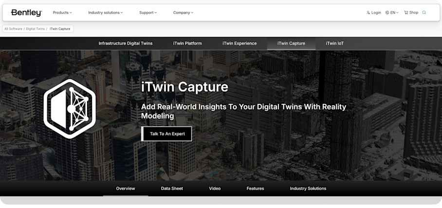
Bentley iTwin Capture is a reality modeling platform. It creates 3D models from photographs and point clouds for infrastructure, transportation, and utility projects. The spatially-classified, engineering-ready reality meshes are suitable at any level of scale, even for an entire city.
Supported formats: E57, LAS, photos, and drone imagery for input. Outputs include OBJ, 3SM, LAS, Cesium 3D Tiles, and IFC.
Accuracy: Engineering-grade photogrammetry with sub-pixel image alignment and support for ground control points.
Scan-to-BIM turnaround: Hours for mesh generation, days for full reality model generation, depending on project scale.
Revit compatibility: Limited direct Revit integration as it is built primarily for the Bentley ecosystem. IFC export available for cross-platform use.
Pricing: The iTwin Capture WorkSuite software license that enables management of point clouds starts at $5,000.
Features
iTwin Capture's features lean heavily toward large outdoor sites:
Photogrammetry-based modeling builds 3D models from photos, drone imagery, and point clouds. You can produce 3D models from photos taken with an ordinary camera or LiDAR point clouds captured with a laser scanner, with fine details and geometric accuracy.
Bentley design integration connects to OpenBuildings, OpenRoads, and the iTwin platform for digital twin management.
Multi-source processing unifies aerial, terrestrial, and mobile mapping data into one model.
Strengths
iTwin Capture excels at large-scale civil infrastructure modeling, including roads, bridges, utilities, and rail corridors. It processes datasets from city-scale aerial surveys to detailed close-range captures.
By combining drone photogrammetry with ground-level scans, it can document spaces where a single vantage point won’t cover the whole asset. Bentley's iTwin platform also supports long-term digital twin management and asset lifecycle tracking after the model is built.
Limitations
iTwin Capture is built for infrastructure, not interior building scans, which limits its usefulness for renovation or interior as-built workflow, where an interior-oriented tool would fit better.
Bentley's licensing model and ecosystem can also feel complex for teams not already using Bentley products. There's a significant learning investment before the platform pays off.
Best for
iTwin Capture is for civil engineering and infrastructure teams that need to model roads, bridges, and large outdoor sites from drone and ground-based capture. It's strongest for organizations already working inside the Bentley design ecosystem.
8. CloudCompare: Best free point cloud processing
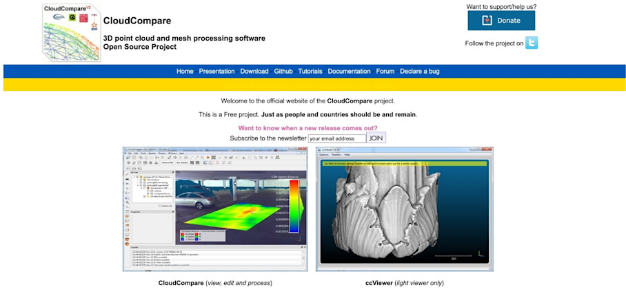
CloudCompare is an open-source, free point cloud processing application used by researchers and budget-conscious teams for viewing, editing, and analyzing 3D point clouds.
Supported formats: E57, LAS/LAZ, PLY, OBJ, PTS, PTX, ASCII, and many more for both input and output.
Accuracy: Depends entirely on the source data, since it preserves rather than modifies scan precision.
Scan-to-BIM turnaround: Highly variable, because it's a manual, open-source toolkit rather than an automated scan-to-BIM solution.
Revit compatibility: No direct Revit integration. Point clouds can be exported in E57 or LAS for manual import.
Pricing: Free and open-source under the GPL license.
Features
CloudCompare packs a wide feature set for a free tool:
Core processing tools cover registration, segmentation, noise filtering, distance computation, and mesh generation.
Broad format support reads and writes an unusually wide range of point cloud file types.
Plugin architecture extends functionality through community-developed add-ons.
Strengths
CloudCompare costs nothing, which makes it genuinely accessible to teams with tight budgets or anyone testing point cloud workflows for the first time. There's no license to justify before you start experimenting.
Its comparison and inspection tools are effective for measuring deviations between point clouds and reference models. It also runs across Windows, macOS, and Linux, so it fits nearly any hardware setup.
Limitations
CloudCompare doesn't produce BIM models directly. It's a point cloud analysis tool, so you'll export processed data to Revit or another authoring platform to actually build the model.
It naturally follows that the interface is less polished than commercial alternatives, with a steeper learning curve for anyone used to guided workflows. Support is community-driven too, so there's no dedicated help desk when a project stalls.
Best for
CloudCompare is a great tool for researchers, students, and small AEC firms who need access to free point cloud analysis, inspection, and preprocessing before moving data into a BIM authoring platform. It's a smart entry point when you want to learn the fundamentals without committing budget.
How to choose the right scan-to-BIM software for your workflow
Feature lists only get you so far. When deciding, consider your team's workflow, the hardware you already own, and the types of projects you take on. Two firms can look at the same tool and reach opposite conclusions because their production realities differ.
The first fork in the road is structural. Teams generally choose between licensing scan-to-BIM software and building in-house modeling expertise, or outsourcing the conversion to a specialized BIM modeling service.
Both work, but you should look at your volume, staffing, and how predictable your project pipeline is.
Start by answering four questions:
How frequently does your team need scan-to-BIM deliverables? Occasional projects rarely justify a full software and hardware investment.
Do you have staff with Revit modeling expertise, or would you need to hire or train? Skilled modelers are the hidden cost behind most processing tools.
What turnaround time do your projects require? Tight deadlines favor automation or outsourcing over manual modeling.
Does your volume justify the cost of software licenses and hardware? Run the math against a per-project service fee before committing.
There's also a middle path. Matterport's BIM file service offers a hybrid model: teams capture spaces themselves and order LOD 200 BIM files directly from the platform, with turnaround as fast as two business days. You can skip the burden of maintaining in-house modeling capacity while still owning the capture step.
Before you sign with any scan-to-BIM vendor or service provider, run through this checklist:
What deliverables are included in the standard output, whether RVT, IFC, DWG, or point cloud?
What LOD is supported, and which elements are modeled at each level?
How is accuracy verified, and what tolerances are guaranteed?
Can the model be used directly in Revit without additional conversion or cleanup?
What is the expected turnaround time, and how does it scale with project size?
Is training or onboarding included with the software license?
Get clear answers to those six questions and you'll avoid the two most common regrets: buying a tool your team can't staff, and signing a service contract that quietly caps quality below what your projects need.
Power your AEC/DCM workflows with Matterport

