


 로그인
로그인5 Best Digital Twin Platforms for AEC: A Buyer’s Guide by Use Case
Architecture, engineering, and construction (AEC) teams no longer wait for a monthly walkthrough to know what a site looks like. Projects move fast, and digital twins have become a common way of documenting real-world conditions to match pace and keep projects on track.
Digital twins follow buildings throughout the project lifecycle: capturing existing conditions, documenting progress, resolving RFIs and coordination, running QA/QC, and delivering a clean handover. The platforms that produce those resources differ in how they capture a space, how accurate the result is, who can access it, and at which stage each one is strongest. The best platform depends on the job in front of you.
This guide compares five of the best digital twin platforms for the AEC industry, so you can match a tool to the workflow you actually need it for.
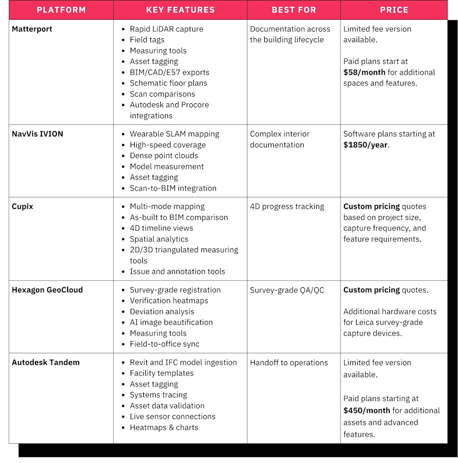
Important note: The tools on this list are organized by best workflow use case, not ranked. Many AEC teams combine more than one, rather than relying on a single tool for every workflow.
1. Matterport: Best for documentation across the building lifecycle
Matterport turns a 3D scan of a construction jobsite or building into a persistent, navigable 3D record. The platform is used across many workflows, from existing conditions through construction to handover, and any stakeholder can open it from a browser link.
Deliverables: A single scan feeds a wide set of outputs for BIM workflows, as-built drawing sets, and more, including:
Point clouds (E57 and XYZ)
3D meshes (.OBJ), including texture maps (.JPG)
CAD files (.DWG and .DXF)
BIM files (.RVT, .IFC, and .RCS at LOD 200)
Schematic floor plans (PNG, PDF, or SVG)
Interoperability: Matterport integrates with a number of major AEC platforms to sync digital twins with project management and spatial data workflows:
Connects to Autodesk Forma, including Docs, Build, and BIM 360, so teams can create and track Issues and RFIs inside the digital twin.
The free Revit plugin imports .XYZ, .E57, .RVT, and .IFC directly, with no separate conversion step.
Procore integration pins RFIs, Observations, and Coordination Issues to an exact location in the model.
Professional Capture Services can also be booked in hundreds of cities for scans produced by local capture technicians.
Standout features
Matterport bundles capture, documentation, and export into one platform, so most AEC jobs run without a separate tool. The platform’s features include:
Property Layout and Automated Measurements: Room dimensions and ceiling heights generated and labeled automatically.
Measurement Mode: In-model measuring captures distances, wall lengths, and object sizes on demand for coordination and fit checks.
Point Cloud Import (Enterprise only): Import survey-grade E57 point cloud data into the same twin, so precision scans and visual documentation live in one platform.
Tags and Notes: Add comments, videos, and attachments to specific locations and assets inside the digital twin, and hold threaded conversations in context.
Side-by-Side (public beta): Compare two twin captures for progress tracking and work verification.
Property Intelligence: Generate property details, including area calculations, room labels, and descriptions using AI.
Field tags (public beta): Add while scanning and offline to capture site context in real time.
Together, these features keep one record useful to designers, engineers, field crews, and owners at the same time.
Strengths & limitations
Matterport's strengths cluster around cadence, access, and portability, and they tie directly to project outcomes:
Documentation cadence without extra field headcount: Accessible LiDAR capture devices and compatible cameras, plus Capture Services, let teams document sites regularly without hiring scan operators.
Browser-based access for every stakeholder: Owners, lenders, AHJs, and subs walk the site from a link, no software install or expertise required. Views and role-based permissions ensure access stays secure and focused.
Downstream data portability: A diverse range of outputs feed workflows seamlessly, instead of sitting siloed in the viewer.
Dispute defense: Documentation workflows track progress for billing and change-order discussions.
Lifecycle continuity: The same twin carries from existing conditions through handover and into facilities use.
The platform reports strong results with AEC teams. B.R. & Co. resolves 75% of project issues without escalation using Matterport, and Gilbane has saved more than 1,000 hours by reducing site visits.
It’s worth keeping in mind that the Pro3 camera’s accuracy is ±20mm at 10m, so the platform is built for visual documentation and coordination rather than survey-grade structural verification. On tight-tolerance scopes, pair it with a survey-grade scanner and use Point Cloud Import to bring that E57 data into the same platform.
Best for
The Matterport digital twin platform is best suited to teams that want one visual record doing several jobs rather than a stack of disconnected viewers. It rewards firms that document often and share widely. For example:
Coordination-heavy projects that need one system to span existing conditions, progress documentation, RFI tracking, and owner handover.
Teams running multiple concurrent projects that need consistent documentation across sites without expanding field staff.
Role-diverse teams that need a source of truth to feed multiple workflows and software systems.
Firms that want non-technical stakeholders to be able to access the site remotely and intuitively.
2. NavVis IVION: Best for complex interior documentation
The NavVis IVION platform produces digital twins from wearable SLAM scanner captures. Instead of setting up tripod positions one at a time, an operator walks the space and the system maps it continuously.
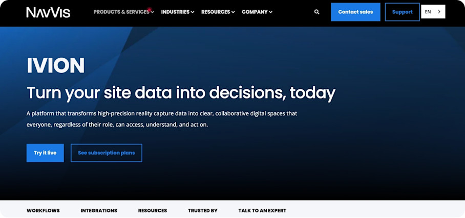
Deliverables: Core AEC outputs from the NavVis IVION platform include:
Dense point clouds (.E57, .PLY, and .RCS)
Panoramic imagery
Scan-to-BIM models (LOD 300)
Floor plans
Interoperability: IVION connects to common point cloud and BIM tools, and its data exports into Autodesk and other downstream modeling software. An API supports integration into larger reality capture pipelines for organizations that manage data at scale.
Standout features
NavVis is engineered for speed and density on big indoor footprints. The platform’s features include:
SLAM-based wearable and trolley mapping: Continuous capture while walking, no per-position setup.
High-speed coverage of expansive floorplates: Large buildings get documented in a fraction of the time tripod scanning takes.
IVION web-based indoor navigation and viewer: Teams can explore and orient inside the mapped space from a browser.
Point-cloud density suited to detailed interiors: Rich datasets support detailed as-built modeling.
Measuring tools: In-viewer measurement for coordination and verification.
Asset tagging: Attach information to equipment and locations within the twin.
These capabilities make NavVis a strong fit where interior complexity is the defining challenge.
Strengths & limitations
NavVis wins on speed across big indoor spaces and on the quality of the data it hands to modelers. Benefits include:
Coverage speed on large indoor footprints that shortens capture time on big buildings.
Dense datasets, supporting scan-to-BIM production by experienced modeling teams.
High point-cloud fidelity to suit detailed environments.
Web viewer access that keeps distributed teams aligned.
However, that speed and data density come at a cost. Hardware and platform pricing sits well above camera-based capture, which can make it hard to justify for small or frequent-cadence documentation. Workflows also require trained operators and a data management process, and output is optimized for technical users rather than owner- or sub-facing walkthroughs.
Best for
NavVis rewards teams with the scale and staff to put its density to work, such as:
Firms taking on high-investment projects for sprawling, complicated interiors like plants, hospitals, and campuses.
Organizations with in-house survey or reality capture teams who can operate hardware and manage dense datasets.
3. Cupix: Best for 4D progress tracking
Cupix is an AI-powered 4D digital twin platform that focuses on tracking progress and validating sites via low-effort, high-frequency capture.
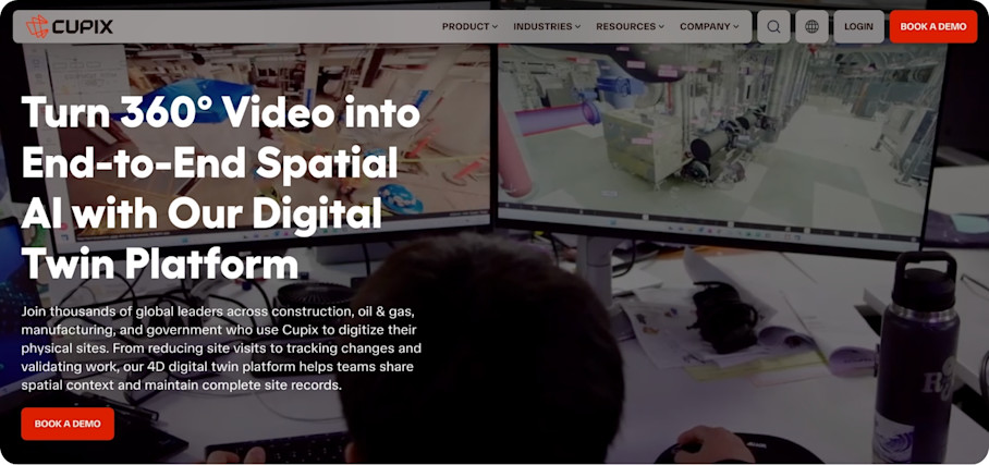
Deliverables: Primary deliverables generated by the Cupix digital twin platform include:
Point clouds (.E57, .PLY, .CPC, and .XYZ)
3D meshes (.GLB and .OBJ)
4D chronological records
Spatially-indexed change logs
BIM “X-rays” and overlays
Interoperability: Cupix connects with common construction management tools like Autodesk, Procore, Oracle, and Revizto.
Standout features
Cupix is built around frequent, low-cost capture and time-based comparison. Its features include:
Multi-mode mapping including 360 video capture: Walking a floor with a 360 camera documents an entire level in minutes.
AI-assisted alignment to floor plans and BIM: Captures snap to the model automatically for consistent positioning.
4D timeline views: Navigate the same location across capture dates to see progress over time.
Spatial analytics: Track quantities and completion against plan.
2D/3D triangulated measuring tools: Pull dimensions from the twin for verification.
OmniNote tagging with voice notes: Attach text and spoken context to exact locations.
These tools make weekly or daily progress documentation practical for teams without capture specialists.
Strengths & limitations
Cost and cadence are the key strengths of Cupix. It gives teams a good idea of whether projects are on track, with:
Low cost and effort of capture supports weekly or daily cadence: 360 walks are quick and inexpensive to repeat.
Accessible workflows for field teams and non-specialists: No reality capture background or heavy software skills are required.
Time-based comparison for delay and change-order defense: PMs get dated evidence for disputes.
Its limits stem from the capture method. Video-derived geometry is less precise than LiDAR or terrestrial scanning, so Cupix is not suitable as a survey tool. Alignment quality depends on the underlying floor plan or BIM model and on consistent capture paths. The platform is also not well suited to pre-design existing conditions or post-handover operations.
Best for
Because Cupix focuses on frequency, not precision, it best fits teams whose main concern is keeping a steady, affordable record of progress. For example:
GCs that need high-frequency progress documentation across active job sites at low capture cost.
Project teams whose primary use case is schedule verification and dispute defense rather than as-built deliverables.
For as-built precision or owner handover, teams typically add a scanning or operations platform like Matterport alongside.
4. Hexagon GeoCloud: Best for survey-grade QA/QC
Hexagon GeoCloud turns survey-grade Leica scan data into cloud-based, meshed digital twins. It's an excellent platform for scopes where millimeter accuracy governs whether work passes.
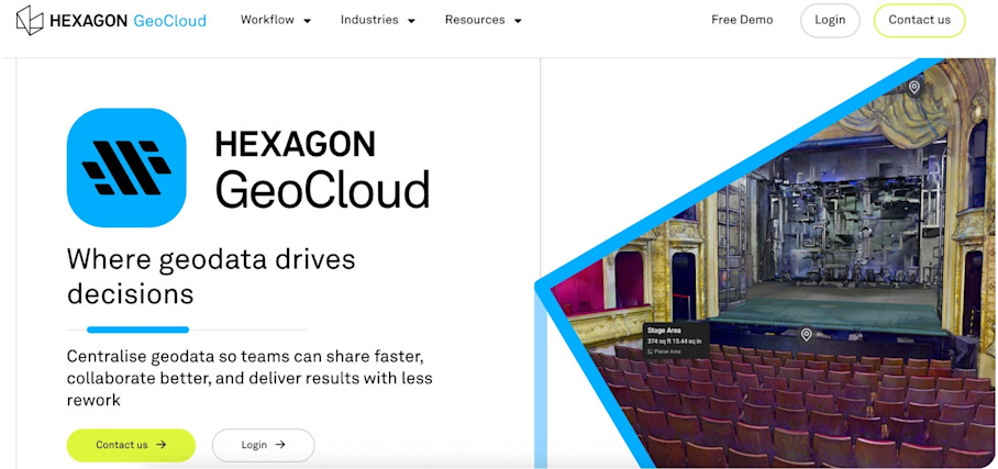
Deliverables: GeoCloud delivers a variety of outputs, including:
Point clouds (.PTS, .LAS, and .LAZ)
3D meshes (.OBJ)
Panoramic images (.JPEG)
Project usage data
Engineering-grade validation reports
Heatmaps showing how as-built conditions compare to design
Interoperability: The digital twin platform is primarily designed to work within the broader Hexagon and Leica ecosystem. There are limited direct integrations to external platforms, so for downstream modeling and analysis, exporting to standard formats is necessary.
Standout features
GeoCloud centers on accuracy that holds up under scrutiny. Its features include:
Total-station measurement for dimensional control: Precise point measurement for layout and verification.
Survey-grade registration of scan data: Scans align to a controlled, accurate coordinate framework.
Deviation analysis for structural QA/QC: Compare as-built geometry against design tolerances.
Verification heatmaps: Visualize where conditions fall inside or outside tolerance.
Engineering-grade validation outputs: Defensible records for structural and legal review.
AI image beautification: Cleaner visuals for reporting.
Field-to-office sync: Data moves from site to processing without manual handoffs.
Asset tagging: Attach information to captured elements.
These capabilities suit scopes where a visual digital twin alone would not stand up to review.
Strengths & limitations
GeoCloud's core strength is for technical workflows:
Accuracy that stands up to scrutiny: Survey-grade data defends verification decisions.
Deep ecosystem maturity: Established training, service, accessories, and registration workflows.
The right tool for verification scopes: Ideal where visual documentation is not defensible.
However, it carries a high total cost of ownership compared to other options and the expense can limit how often teams document. And because the deliverables are also technical by nature, you’ll likely have to add a lighter viewer alongside it to serve the rest of the team.
If you want to extend use of your survey data, a simple workflow turns a Leica scan into a Matterport digital twin, making it more accessible to owners, subs, and other non-technical stakeholders.
Best for
GeoCloud fits projects with existing technical workflows where precision is key. For example:
Teams already invested in Leica scanners that want automated cloud processing and sharing.
Projects requiring survey-grade capture for QA/QC and dimensional control.
Structural and engineering validation where visual documentation alone is insufficient.
Most portfolios use it selectively for tight-tolerance scopes while relying on lighter tools for everyday documentation.
5. Autodesk Tandem: Best for handoff to operations
Autodesk Tandem is an operations-focused digital twin platform. It ingests design and construction data and structures it so owners and facilities teams inherit a usable, data-rich twin at handover.
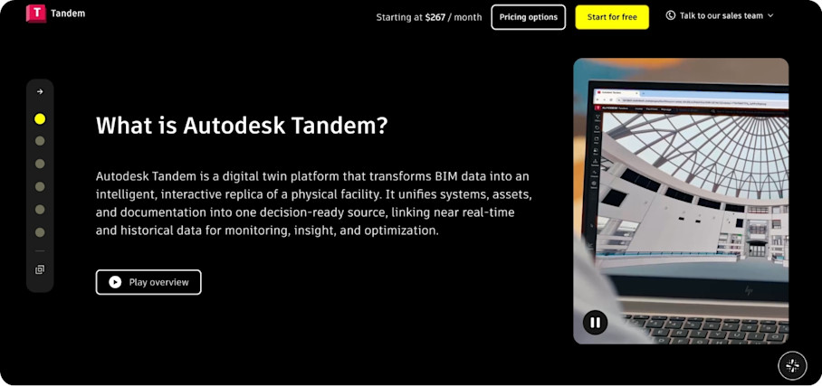
Deliverables: Tandem’s digital twins are populated with asset data, systems and space relationships, and outputs include:
Asset inventories
Connection information
Change history
Dashboard exports
Heatmaps and charts
Facility templates
Interoperability: Tandem offers over 60 low-code, drag-and-drop plugins to link building operations and facility systems via Tandem Connect.
Standout features
Tandem is built to carry project data into operations, rather than to capture a site. Its features include:
Model ingestion from Revit and IFC to build an operations twin from existing project data.
Facility Templates: Make digital twin creation repeatable across multiple projects for data consistency.
Tandem Categories: Organize uploaded model data into high-level default groups automatically for fast navigation.
Systems and space tracing: Follow how systems run through the building and which spaces they serve.
Connections to live data and sensors for monitoring.
These features make Tandem a fit for owners who want a structured digital twin at closeout.
Strengths & limitations
Tandem's strengths lie in post-handover operations:
Directly targets the handover gap: Structures project data for operations from the start.
Native fit for Revit and ACC teams: Slots into existing Autodesk workflows.
A reason to demand better data discipline: Gives owners leverage to specify quality attribute data during construction.
However, Tandem is not a reality capture tool, so it depends on the accuracy and completeness of existing models. Its value drops on projects with weak BIM discipline or renovation work with no reliable model. It primarily serves owners and facilities teams rather than the field.
Best for
Tandem pays off when strong BIM data already exists to feed it, and targets the final closeout hurdles where project data may be lost. It’s well-suited to:
Owners and owner's reps who want a structured operations twin as a contractual handover deliverable.
GCs and A/E firms standardized on Revit and Autodesk Forma who need to satisfy owner data requirements at closeout.
How to match a digital twin platform to your AEC workflow
Choosing the best digital twin platform for your AEC workflows is much easier when you can measure each candidate against a real project.
Run every criterion below against a real scope before you commit, considering the following.
Deliverables and export formats: Check that the exact formats your downstream teams need are available, including E57 and XYZ point clouds, RVT and IFC, DWG and DXF, floor plans, 3D walkthroughs, and asset records.
Integrations and APIs: Verify direct connections to the tools you already run, and test whether issues and RFIs sync both ways rather than one direction only.
Accuracy matched to tolerance: Classify the scope of the platform before you buy. Most AEC portfolios need both visual documentation and survey-grade data, so you’ll probably want to plan for a mix.
Capture speed and scalability: Examine how the digital twin will be captured, whether you’ll need to add field staff, and whether a managed capture service exists for overflow or distant projects.
Access, roles, and permissions: It’s a good idea to look for browser access for non-technical stakeholders plus secure, role-based controls for sensitive projects.
Total cost of ownership: Model software subscriptions, capture hardware, training, service turnaround fees, and ongoing hosting or data volume charges, not just the sticker price.
Lifecycle continuity: Check whether the record will survive past closeout for other workflows like facilities use and future renovations.
Matterport’s digital twin platform holds up across that whole checklist for most AEC teams, lasting from existing conditions through handover and into operations. And when you need survey-grade precision on a specific scope, you can import that data into the same twin rather than starting over.
Matterport로 AEC/DCM 워크플로를 강화하세요


